Cycling The Marriott's
Way |
Cycle
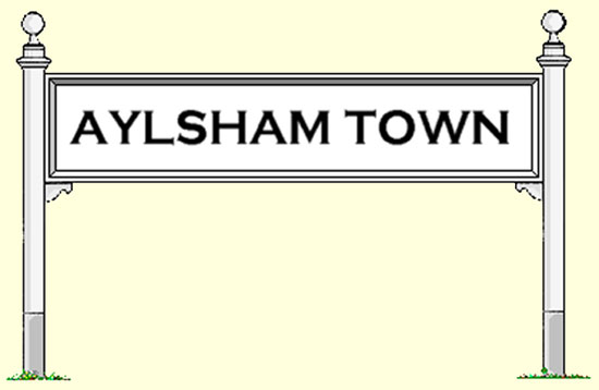
Ride Two Reepham to Reepham - Approximately 18 miles Wednesday 6th August 1997 Benjamin and I decided to brave the wilds of the Norfolk Countryside once again and venture out on another cycle ride exploring the byways and disused railways of Norfolk getting some of that all important exercise. This time we were hopping to find the site of the old Aylsham North, M&GN station. |
|
First
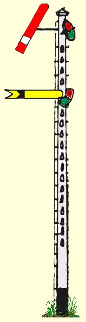
a brief look at the history of the line. The section we planed to follow was part of the route which crossed Norfolk from Kings Lynn in the West via Fakenham, Melton Constable and North Walsham. Its construction took eight years and three named companies who were nominally separate, but were very much inter linked, and under control of the same contractor Wilkinson & Jarvis. The building of the line progressed from opposite sides of the county. The Yarmouth & Stalham (light) Railway" opened the first section from Yarmouth Beach to Ormesby on 7th August 1877, then on to Hemsby on 16th May 1878, to Martham on 15th July 1878 ,to Catfield on 17th January 1880, reaching Stalham on 3rd July 1880 under the name of The Yarmouth & North Norfolk Railway" who opened an extension to North Walsham on 13th June 1881. Meanwhile in west Norfolk The Lynn & Fakenham Railway was authorised on 13th July 1876 and opened to Fakenham on 6th August 1880. Ten years later on 1st July 1893 these companies were again incorporated into the. Midland & Great Northern Joint Railway (M&GN ) which survived as an independent company until October 1936 when it passed into the hands of the. London North Eastern Railway. (LNER) and on to National ownership on 1st January 1948 under. British Railways. ( BR ). The 28th February 1959 saw the closure of almost the entire M&GN route as road haulage was nationalised and became more competitive, I suppose we must consider ourselves fortunate that a small part of that system survives today from Cromer Beach to Sheringham under the control of Railtrack. and The North Norfolk Railway who operates the preserved section from Sheringham to a new station at Holt, keeping the memories alive for those who remember the M&GN. Despite the number of companies associated with this line throughout its history it will always be known locally with affection as 'the M&GN'. sometimes unkindly as " the muddle and go nowhere". |
 |
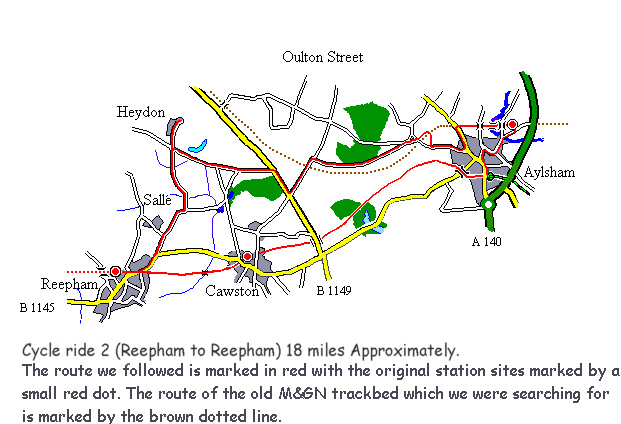 Route Map |
 |
Off
We Go then |
 |
With our
back pack filled with the usual essentials we set off at 10.20 am from
Reepham station where we had parked the car, Our plan was to try and trace
the old M&GN track bed and follow it into Aylsham where we hopped
to find some remains of the station and any other traces of the railway's
existence on the way, then return to Reepham via Cawston on the 'Marriott's
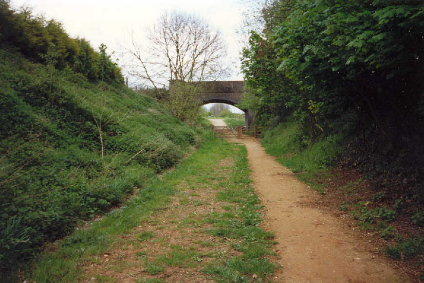
Way'. the once Great Eastern route from Wroxham to County School. The first section from Reepham on the B 1145 as expected was busy with traffic made worse by road works but soon improved as we turned left and cycled past Salle church and through to Heydon, (probably the prettiest part of the ride). We arrived at Heydon where we spent ten minutes or so on a seat by the village green, Benjamin hadn't been here before and remarked how idyllic it was, he took a photograph before we continued our journey (unfortunately it didn't capture the scene as well as expected so its not included in this article). We found our way onto the B1145 and traveled for a short distance toward Norwich before turning left into a byroad sign posted Oulton Street. after a few hundred yards we came across a gate keepers cottage where the M&GN line once crossed the road, we stopped at this point and referred to the O/S map to try and establish roughly the route e line took from here, we decided to turn right and follow the road to Aylsham, it appears that the line once followed this road for some distance but it wasn't easy to define its route, after all, almost forty years have passed since its closure and in common with a great deal of redundant track bed throughout the country its been reclaimed by the local farmers for cropping. We eventually came to an area called Able Heath (NT). At this point a deep cutting was visible running towards Aylsham, the road formed a Z bend here and judging by the depth of the cutting there must have been a bridge at this point to carry the road over the railway. A council notice was posted here proposing changes to the Public Foot Path system in this area. We decided to try and cycle through the cutting but had to abort after a very short distance, "STINGING NETTLES" (the 8 ft variety) drove us out. After leaving the cutting we continued in the direction of Aylsham along the side of the cutting which ended abruptly at a barley field, a public footpath ran along the hedge row so we followed it back to the road and cycled toward Aylsham, we picked up the track bed again where it once crossed the B1354 between Aylsham and Blickling, the original crossing point here was beneath a brick arched bridge, still intact, but now isolated because of road realignment. From here the path was well used, obviously popular with local people, and forms part of the 56 mile Weavers' Way. We continued along the path to the west of Aylsham and towards where we expected to find the former site of the old M&GN station, we were not sure of its exact location but old photographs show a brick arched bridge at the western end of the station, carrying a road over the line, if it still remains today then that should give us a clue. After a couple of hundred yards we eventually came across an arched bridge, could this be it? we thought not, the track bed is on an embankment, it couldn't possibly be, we cycled on and after crossing a bridge over the river Bure another road bridge came into view, Yes, This looked like it. |
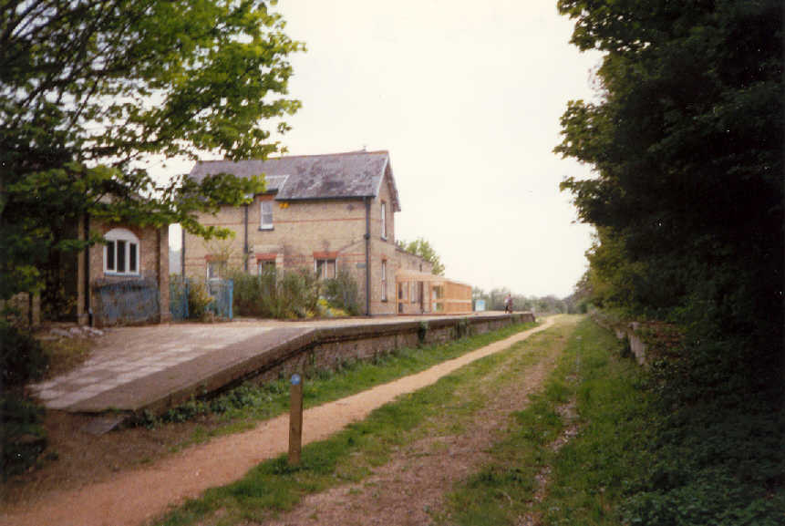 Reepham Station Looking west toward Foulsham |
Sadly
nothing remains of the station complex at all, a link road to the Aylsham
bypass has been built over the track bed and sidings, not a period railway
building in sight, although we did observe what might have been a small
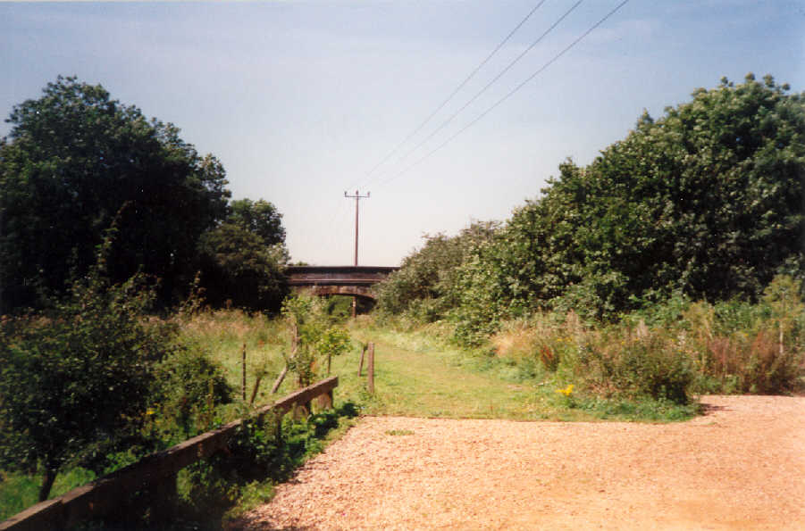
goods shed on the other side of the link road. A small parking area has been provided for people who like to park and walk the path. it occupies an area of land roughly where the track bed and platforms once were. Benjamin took a photograph of the bridge (No.128) from this car park looking in the direction of Melton Constable. Now time for some lunch, We decided we would have our lunch at the Bure Valley Railway, The site of the Bure Valley railway was once occupied by Aylsham's second railway station, built by the Great Eastern Railway in 1883. of which nothing remains today. We cycled through the town and being such a perfect day for a picnic we eat our lunch sitting on the grass bank overlooking the Bure Valley Station, After lunch we visited the gift shop and took a little time to observe the arrival of a train from Wroxham, we also contemplated maybe on a future cycle ride, we might cycle the path from here to Wroxham (a distance of some 12 miles) beside the railway line, but on inspection of the route it is clearly stated that no cycling is permitted on this path. Across the road from the station is the beginning of "The Marriott's Way" which runs from here to Hellesdon a distance of some 22 miles, We set off along this route on the final leg of cycle ride which will return us to Reepham, (a distance of 6 miles). We found this section very popular with cyclists including quite a number of families, I suppose with the cycle hire centre at Reepham, Aylsham would be the obvious choice for a short round trip. On route we passed over the B1145 just South of Aylsham and after a couple of miles under the B1149 Norwich to Holt road before arriving at Cawston, we walked for a short distance along the path by Cawston station (described previously in cycle ride No.1) then mounted up for the final push, the fast stretch into Reepham station, We arrived at Reepham at 2.40 p.m. 3 hours 20 minutes after departing. |
 View from Reepham looking north toward Aylsham |
|
 The site of Aylsham (Ex M&GN Station) looking west toward Melton Constable |